
The Best Fall Hikes in the Berkshires (and Where to Warm Up After)
Foliage season in the Berkshires is not one weekend — it is a moving target that rolls across the county over three weeks. Here is where to walk, when each corner of the county tends to turn, and how to plan around the small trailhead lots that fill by nine in the morning.
Every October, we field the same question at the front desk: where should we hike today? It is a better question than it sounds, because the honest answer changes week to week. The Berkshires do not peak all at once. The high country in the north turns first; the valley towns around Lenox hold their color considerably later. Plan around that and you get a spectacular walk. Ignore it and you can drive an hour to find bare branches or stubborn green.
Below are eight walks we actually send guests on, sorted roughly by effort — from a stroll you can start on foot from our front door to the highest summit in Massachusetts.
When Is Peak Foliage in the Berkshires?
There is no single date, and anyone who gives you one is guessing. The pattern that holds most years, according to the state’s foliage tracking, is this: the northern Berkshires and the eastern and western edges of the county turn first, usually around the middle of October. A central band — which includes Lenox, Lee, Stockbridge, Tyringham, West Stockbridge, Richmond and Great Barrington — tends to peak noticeably later, often into the final week of October. By the first week of November, the county is generally past peak.
That gives you a genuinely useful planning rule:
- Early to mid-October: drive north. Mount Greylock and the Hoosac Range are usually turning while the valley is still green.
- Late October: stay close to Lenox. Kennedy Park, Yokun Ridge and Pleasant Valley are often at their best exactly when visitors assume they have missed the show.
Weather shifts this by up to two weeks in either direction, so treat it as a pattern rather than a promise.
Kennedy Park, Lenox — The One You Can Walk To
Distance from Garden Gables: on foot from Main Street | Trails: roughly 15 miles of old carriage roads | Difficulty: easy to moderate | Cost: free
If you want a hike without getting in the car, this is it. Kennedy Park’s trailhead sits on Main Street beside the Church on the Hill — the same street as the inn — and from there roughly fifteen miles of groomed former carriage roads wind up through hardwood forest to a mountain vista. The old carriage grades mean the climbing is gradual rather than brutal, which makes this the rare hike that suits both a serious morning out and a post-breakfast amble.
There is a second trailhead at the Arcadian Shop lot on Route 7, where you can also pick up a trail map. Our advice: go in the late afternoon in the last week of October, when the light comes in sideways through the hardwoods.
Planning a foliage weekend? See our rooms and check availability →
Olivia’s Overlook & Yokun Ridge, Lenox — The Best View for the Least Effort
Distance from Garden Gables: 3 miles — Route 183 west past Tanglewood, then right onto Richmond Mountain Road | Trails: over 6 miles across 734 acres | Difficulty: moderate | Cost: free
Here is the trick most visitors miss: the overlook itself is roadside. You park, walk a few steps, and the Stockbridge Bowl opens up below you. For guests who want the view without the climb — or who are traveling with someone who does — this is the single best stop in the county.
If you do want to walk, the Berkshire Natural Resources Council maintains several options from the same lot. The Charcoal Trail is a 1.6-mile round trip of about an hour, with views toward Monument Mountain and West Stockbridge. The Burbank Trail, starting directly across the road, runs 3.2 miles round trip in roughly two hours. BNRC itself flags this reserve as especially good in fall.
The history here is worth knowing as you walk. This land was part of Shadowbrook, the Gilded Age estate of Anson Phelps Stokes — the third-largest private house in the country when it was built in 1893. It burned in 1956, and the Jesuits who then owned the property rebuilt on the site that is now Kripalu. Nathaniel Hawthorne named Shadow Brook itself, and described the gorge along the Brothers Trail as a “shady nook where summer had cooled herself.”
Pleasant Valley Wildlife Sanctuary, Lenox — The Serious Climb Close to Home
Address: 472 West Mountain Road, Lenox | Trails: 7 miles across 1,405 acres | Cost: $5 adults, $3 seniors 65+, $3 children 2–12; Mass Audubon members free | Note: dogs are not permitted
Mass Audubon’s sanctuary gives you the most vertical gain you will find without leaving Lenox. The Trail of the Ledges / Overbrook Loop is a 3-mile round trip of about two hours, climbing 850 vertical feet to the summit of Lenox Mountain at 2,126 feet. On a clear day you can see Mount Greylock to the north, the Taconic Range west, and the Catskills off to the southwest.
One piece of advice we pass along every time, straight from Mass Audubon: hike the Trail of the Ledges up, not down. The slopes are steep and can be slippery — which matters considerably more in late October, when the tread is under an inch of wet leaves.
Not looking to climb? The All Persons Trail / Pike’s Pond Trail is mostly flat, under a mile, and takes twenty to thirty minutes, with interpretive features along the way. The Yokun / Beaver Lodge Loop is an easy 1.5-mile hour with beaver ponds and ridge views.
The nature center is open daily 9:00 am to 4:00 pm; trails are open dawn to dusk.
Tyringham Cobble, Tyringham — The Quiet One
Address: 20 Jerusalem Road, Tyringham | Trail: 2-mile loop, moderate with strenuous sections | Cost: free | Parking: 16 cars
A two-mile loop over the twin knobs of the Cobble, including a stretch of the Appalachian Trail, opening onto a wildflower field at the top with panoramic views down the Tyringham Valley. Allow at least ninety minutes. Look for the formation known as Rabbit Rock, and the marble columns of Ashintully Gardens visible across the valley.
The catch is the parking lot: sixteen cars. On a peak-color Saturday that is gone early. This is a hike to do on a weekday, or first thing in the morning.
The Trustees of Reservations have owned it since 1963, when the descendants of a group calling themselves “The Cobblers” gave it over. The Cobblers had bought the land in the 1930s specifically to stop a proposed ski run.
Monument Mountain, Great Barrington — The Classic
Trailhead: Route 7, Great Barrington | Trails: all under three miles | Cost: $10 parking for non-members; Trustees members free | Parking: 56 cars
The most famous hike in the southern Berkshires, and deservedly so. Three routes lead to Peeskawso Peak at 1,642 feet: the Mohican Monument Trail (1.5 miles, the gentler ascent, past stone walls of former sheep pastures and old charcoal hearths), the Hickey Trail (0.83 miles, the most direct and most strenuous), and the Peeskawso Peak Trail (0.62 miles), which connects both and carries the best views. From the top: the Housatonic Valley, Mount Greylock, and the Catskills.
More than 20,000 people climb it each year, and the 56-space lot reflects none of that. Go early on weekends.
The mountain has been sacred to the Mohican people since time immemorial; tribal members left stone offerings that formed the “monument” it is named for. In 1850, Hawthorne and Melville spent an afternoon on this mountain that fed directly into Moby-Dick.
Dogs are welcome on leash.
Hoosac Range, North Adams — Best in the North, Best in Early October
Trailhead: the “Western Summit,” Route 2 east of North Adams, past the Hairpin Turn | Cost: free
BNRC flags this one as especially good in fall, and specifically notes migratory raptors overhead in autumn — which is reason enough to bring binoculars. Two options from the same lot: Sunset Rock is an easy 1.6-mile round trip of about an hour and fifteen minutes, looking west and north over North Adams. Spruce Hill is a serious 6-mile round trip of roughly four hours along the ridgeline, ending in 180-degree views that include Mount Greylock.
Because it sits in the northern part of the county, this is an early-to-mid-October hike rather than a late-October one.
Mount Greylock, Lanesborough — The Highest Point in Massachusetts
Visitor Center: 30 Rockwell Road, Lanesborough, open daily 9:00 am–12:30 pm and 1:00–4:00 pm | Summit: 3,491 feet — views up to 90 miles on a clear day
The one everyone wants to do, with one date that governs everything: the summit auto roads are open for the 2026 season through October 30. After that, Rockwell Road and Notch Road close for the winter and the summit becomes a hiking-only proposition. The Visitor Center itself stays accessible to vehicles year-round.
Two other things worth knowing before you set out. Vehicles longer than 22 feet are prohibited on the auto roads — relevant if you are traveling in an RV or large van. And the drive up is steep with hairpin turns; give yourself more time than the mileage suggests.
At the top: the 93-foot Veterans War Memorial Tower, built in 1932, and Bascom Lodge, a Civilian Conservation Corps building from the 1930s that serves meals in season.
Bash Bish Falls, Mount Washington — The Waterfall
Trail: 0.6 miles round trip from the Massachusetts lot (strenuous), or 1.5 miles round trip from the New York side (moderate, gradual) | Cost: free | Parking: 24 cars on the Massachusetts side
The tallest waterfall in Massachusetts drops about sixty feet into a plunge pool, and it is genuinely worth the drive to the far southwest corner of the county. Two approaches: the Massachusetts lot on Falls Road gives you a short but rugged and steep descent; the New York lot at Taconic State Park in Copake Falls gives you a longer, gradual, rocky mile and a half.
Two hard constraints. The Massachusetts lot holds 24 cars, and roadside parking on Falls Road or Route 344 is not permitted at any time — so on a peak weekend, plan on the New York approach. And access to the falls themselves is restricted to the dedicated viewing area: no entering the water, no swimming, no climbing. Carry in, carry out; there are no trash cans.
A Few Things We Tell Every Guest Before They Head Out
- Small lots are the real constraint, not the trails. Tyringham Cobble holds 16 cars, Bash Bish 24, Monument Mountain 56. On a peak-color Saturday, arriving at nine is arriving late.
- Wear orange in the fall. Hunting is permitted in season at Monument Mountain, Tyringham Cobble, Yokun Ridge and the Hoosac Range. It is not permitted on Sundays at the Trustees properties.
- Check the dog rules per property. Leashed dogs are welcome at Monument Mountain and Tyringham Cobble, but dogs are prohibited at Pleasant Valley.
- Wet leaves are slicker than they look. Steep descents that are trivial in July are genuinely treacherous in late October.
- Layer. A summit in the Berkshires in late October is a different climate from the valley floor you started in.
Frequently Asked Questions
When is peak fall foliage in the Berkshires? There is no single date. Typically the northern Berkshires and the county’s eastern and western edges peak around mid-October, while a central band including Lenox, Lee, Stockbridge and Great Barrington peaks later, often into the last week of October. The whole county is generally past peak by the first week of November. Weather can shift this by up to two weeks.
What is the best fall hike near Lenox, MA? For the best view with the least effort, Olivia’s Overlook at Yokun Ridge — three miles from the inn, with a roadside viewpoint over the Stockbridge Bowl. For a real climb, the Trail of the Ledges at Pleasant Valley Wildlife Sanctuary gains 850 feet to the summit of Lenox Mountain. For a hike you can start on foot from Main Street, Kennedy Park.
Are there easy fall hikes in the Berkshires? Yes. The All Persons Trail at Pleasant Valley is flat and under a mile. Olivia’s Overlook gives you a panoramic view a few steps from the car. Kennedy Park’s old carriage roads climb gradually rather than steeply.
Do I need to pay to hike in the Berkshires? It varies. Kennedy Park, Tyringham Cobble, Yokun Ridge, the Hoosac Range and Bash Bish Falls are free. Monument Mountain charges $10 for non-member parking. Pleasant Valley charges $5 for adults, $3 for seniors and children. Members of the Trustees and Mass Audubon get in free at their respective properties.
Can I still drive to the summit of Mount Greylock in the fall? Yes, through October 30, 2026. After that the summit auto roads close for the season, though the Visitor Center in Lanesborough stays accessible year-round.
Where should I stay for a Berkshires fall hiking trip? Lenox puts you within a short drive of nearly everything on this list and within walking distance of Kennedy Park. Garden Gables sits on Main Street in the village. Check availability →
Where to Warm Up After
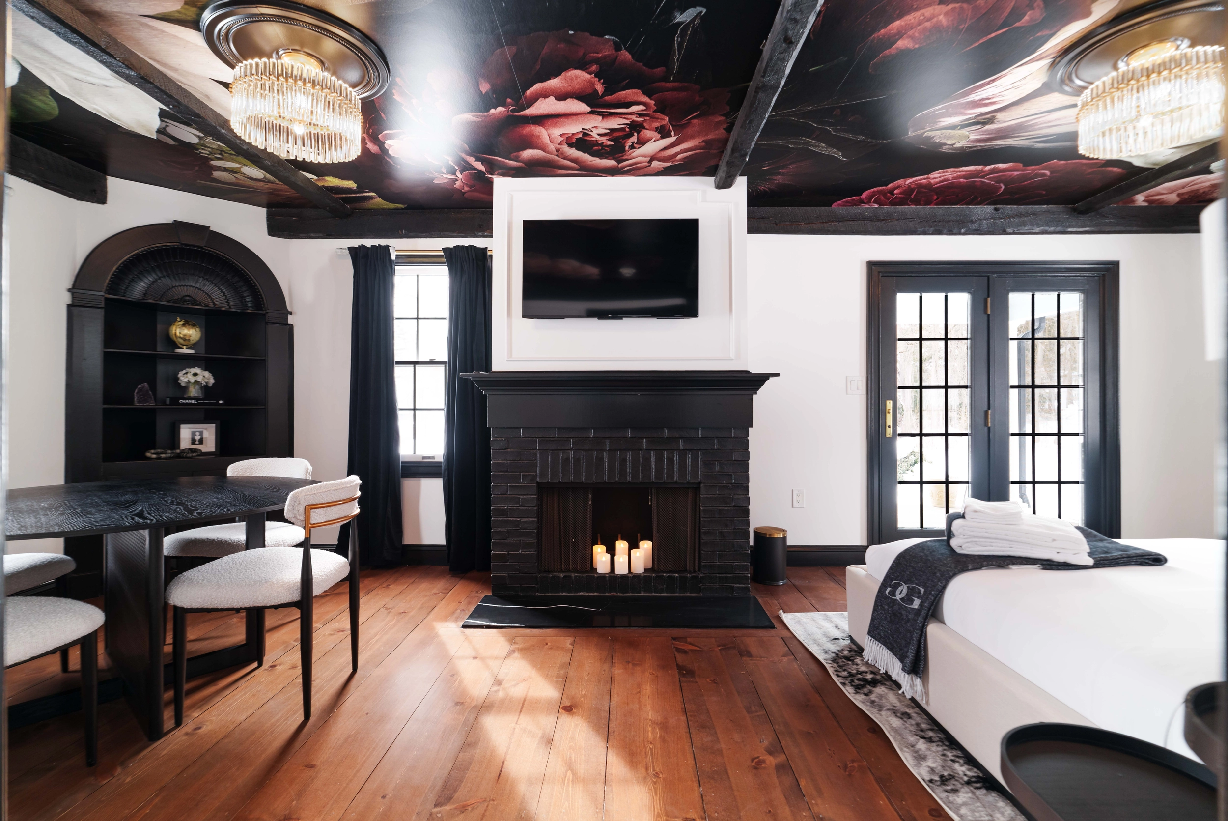
The best part of an October hike in the Berkshires is what comes after it — and Lenox is well set up for that. Our guests tend to come back muddy and happy in the late afternoon, and the village’s restaurants are a short walk from our front door. If you want specifics, our guide to the best restaurants in Lenox covers where we actually send people.
Garden Gables sits on Main Street in Lenox, with Kennedy Park’s trailhead a short walk away and most of this list inside a half-hour drive. Foliage weekends book earlier every year.
- Location: 135 Main Street, Lenox, MA 01240
- Bookings: Explore our rooms
- Discover more: The area • When to see peak foliage in the Berkshires • Beyond leaf-peeping: a fall culture guide
suggested articles
Christmas in the Berkshires: A Lenox Guide to Winterlights, Stockbridge, and the Quiet Season
There is a stretch of the Berkshires calendar that regulars keep a little quiet. The leaf-peepers have gone home, Tanglewood is dark, and for about six weeks Lenox settles into something…

The Lenox Apple Squeeze 2026: What to Know Before You Go
The 45th Lenox Apple Squeeze is Saturday, September 26, 2026, 10am to 5pm. What is on, where to park, and how to build a Berkshires weekend around it.
You Live Two Hours Away: A New Englander’s Guide to the Berkshires After the Leaves Fall
The Berkshires do not close after Columbus Day. A local's guide to Lenox from November through March - what is open, what is quiet, and how New England residents save 15%.

Beyond Leaf-Peeping: A Fall Culture & Rainy-Day Guide to Lenox and the Berkshires
The leaves get all the attention in October — but the Berkshires give you far more than color. Here are the museums, historic estates, cozy tables, and rainy-day retreats that make…
When to See Peak Fall Foliage in the Berkshires: A 2026 Weekend-by-Weekend Guide
Trying to time your Berkshires leaf-peeping trip just right? Here is a weekend-by-weekend look at the 2026 foliage season around Lenox — when color usually arrives, which weekends give you the…

A Romantic Getaway in Lenox: The Perfect Berkshires Escape for Two
Candlelit dinners, quiet walks in the hills, and a fireplace-lit room to call your own — here is how to plan an unforgettable romantic escape to Lenox. Some places just feel…
A Perfect Summer Day in Lenox: Hikes, Gardens & Farm-to-Table Dining
A morning on the trails, an afternoon among the gardens, and an evening of farm-to-table dining — here is how to spend one flawless summer day in Lenox, with a boutique…
Fall Foliage in the Berkshires: A Lenox Leaf-Peeping Weekend at Garden Gables
A guide to peak color, the best drives and hikes, and the cozy Lenox home base that makes autumn in the Berkshires unforgettable. There is a particular kind of quiet that…

The Ultimate Guide to Things to Do in Lenox: A High-End Itinerary for the Wellness-Obsessed
Lenox is more than a destination. It is a frequency. For the wellness obsessed, this corner of the Berkshires represents a rare alignment of natural beauty, historic grandeur, and world class…
Looking For Things to Do in Lenox MA? Here Are 10 Hidden Gems Every Local Loves
Lenox is often defined by its grandest stage, the summer home of the Boston Symphony Orchestra. While the pull of a moonlit concert at Tanglewood is undeniable, those who live and…

A Different Kind of Mother’s Day in Lenox
Flowers are nice. Brunch is fine. But a weekend that does not ask anything of her? Better. That is the idea behind a different kind of Mother’s Day Lenox escape at…


